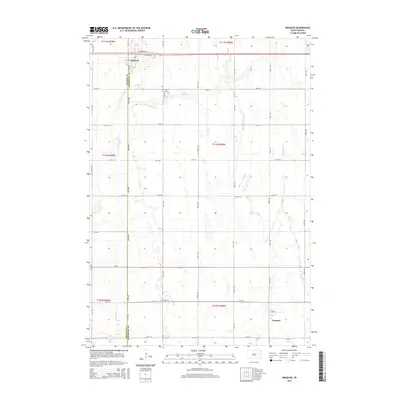
2015 Map of Iroquois
USGS Topo · Published 2015About this map
The town of Iroquois anchors the northwestern corner of this landscape, situated along the Beadle Co Kingsbury Co border. This survey captures a rural prairie environment defined by its section-line road grid and intermittent watercourses. To the east of town, Lake Iroquois serves as a central hydrological feature, while the surrounding acreage is drained by S Fork Pearl Cr and W Redstone Cr.
Find a feature on this map
31 named features on this map. Tap any name to fly to it.
Don’t see what you’re looking for? This feature index may not catch every label — zoom into the map to look around manually.
Map Details
Editions of this 2015 Iroquois Map
This is the sole edition of this map. No revisions or reprints were ever made.
Other maps of this area

1899 · De Smet
USGS Topo · 1:125,000

1953 · Watertown
USGS Topo · 1:250,000

1958 · Watertown
USGS Topo · 1:250,000

1971 · Iroquois
USGS Topo · 1:24,000
1971 · Artesian NW
USGS Topo · 1:24,000
1971 · Pearl Creek Colony
USGS Topo · 1:24,000

1971 · Bancroft East
USGS Topo · 1:24,000

1971 · Bancroft West
USGS Topo · 1:24,000
1971 · Yale
USGS Topo · 1:24,000

1971 · Artesian NE
USGS Topo · 1:24,000