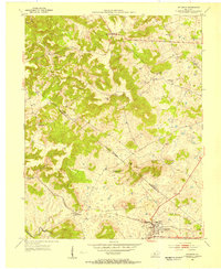
1953 Map of Irvington
USGS Topo · Published 1954About this map
The Louisville and Nashville railroad corridor serves as the primary artery through this 1950s Kentucky landscape, connecting the hub of Irvington with the smaller community of Webster. This era of the Pennyroyal Plain is defined by its small-scale rural infrastructure, where local life centered around neighborhood schools such as Bunker Hill Sch, Fairmount Sch, and Arnold Sch. The boundary between Meade and Breckinridge counties cuts diagonally across the terrain, passing through a mix of upland ridges like Hogback Hill and the winding course of Sinking Creek in the southwest.
Find a feature on this map
20 named features on this map. Tap any name to fly to it.
Don’t see what you’re looking for? This feature index may not catch every label — zoom into the map to look around manually.
Map Details
Editions of this 1953 Irvington Map
This is the sole edition of this map. No revisions or reprints were ever made.
Other maps of this area

1928 · Hardinsburg
USGS Topo · 1:48,000

1931 · Hardinsburg
USGS Topo · 1:62,500

1931 · Corydon
USGS Topo · 1:62,500

1941 · Ekron
USGS Topo · 1:62,500

1947 · Irvington
USGS Topo · 1:24,000

1947 · Lodiburg
USGS Topo · 1:24,000

1947 · Hardinsburg
USGS Topo · 1:24,000

1947 · Garfield
USGS Topo · 1:24,000

1947 · Mauckport
USGS Topo · 1:24,000

1947 · Hardinsburg
USGS Topo · 1:62,500