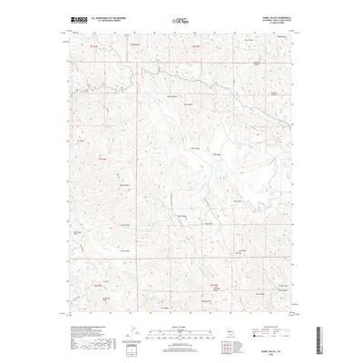
2018 Map of Isabel Valley
USGS Topo · Published 2018About this map
Isabel Valley and the surrounding reaches of the Diablo Range define this portion of the California interior. The landscape is characterized by a complex network of high ridges and narrow canyons, with drainage provided by Arroyo Bayo, Isabel Cr, and the Middle Fork Coyote Cr. Human activity is concentrated along several primitive routes such as the Isabel Creek Trl and Mule Trl, which connect the valley floors to high-elevation landmarks like Mt Isabel and Sugarloaf Mtn. The eastern edge of the survey includes the small settlement of Grizzly Flats near Skunk Hollow. This map captures the intricate topography of family-named features including Henderson Ridge, Bollinger Mtn, and Jays Ridge, reflecting the localized history of land use and seasonal grazing in the mountain valleys above San Jose.
Find a feature on this map
45 named features on this map. Tap any name to fly to it.
Don’t see what you’re looking for? This feature index may not catch every label — zoom into the map to look around manually.
Map Details
Editions of this 2018 Isabel Valley Map
This is the sole edition of this map. No revisions or reprints were ever made.
Other maps of this area

1897 · Mt. Hamilton
USGS Topo · 1:62,500

1917 · Morgan Hill
USGS Topo · 1:62,500

1921 · Gilroy Hot Springs
USGS Topo · 1:62,500

1938 · Mt. Boardman
USGS Topo · 1:62,500

1939 · Morgan Hill
USGS Topo · 1:62,500

1939 · Gilroy Hot Springs
USGS Topo · 1:62,500

1940 · Gilroy Hot Springs
USGS Topo · 1:62,500

1941 · Morgan Hill
USGS Topo · 1:62,500

1942 · Mt. Hamilton
USGS Topo · 1:62,500

1942 · Mt. Boardman
USGS Topo · 1:62,500