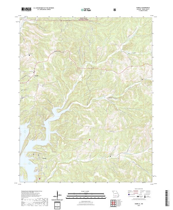
2021 Map of Isabella
USGS Topo · Published 2021About this map
Isabella and Pontiac anchor this landscape of deeply carved hollows in the Ozark highlands of southern Missouri. The area is defined by the winding northern reaches of Bull Shoals Lake, where the undulating shoreline meets a complex network of drainages like N Fork Bratten Spring Cr and Gulley Spring Cr. This modern survey reveals a countryside where historical family legacy remains highly visible through a dense concentration of upland burial grounds.
Find a feature on this map
72 named features on this map. Tap any name to fly to it.
Don’t see what you’re looking for? This feature index may not catch every label — zoom into the map to look around manually.
Map Details
Editions of this 2021 Isabella Map
This is the sole edition of this map. No revisions or reprints were ever made.
Other maps of this area

1890 · Mountain Home
USGS Topo · 1:125,000

1891 · Mountain Home
USGS Topo · 1:125,000

1893 · Yellville
USGS Topo · 1:125,000

1894 · Mountain Home
USGS Topo · 1:125,000

1903 · Yellville
USGS Topo · 1:125,000

1905 · Yellville
USGS Topo · 1:125,000

1929 · Yellville
USGS Topo · 1:125,000

1934 · Gainesville
USGS Topo · 1:48,000

1936 · Thornfield
USGS Topo · 1:48,000

1940 · Gainesville
USGS Topo · 1:62,500