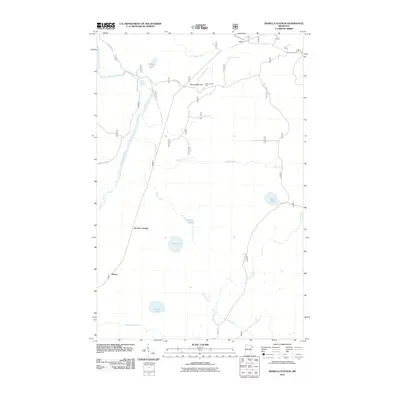
2011 Map of Isabella Station
USGS Topo · Published 2011About this map
The Stony River winds through this northern Minnesota wilderness, defining a landscape of dense forests and scattered glacial lakes. Near the small settlement of Isabella, the Stony Lookout Tower stands atop Stony Tower Hill, serving as a critical high-point for fire observation within the Superior National Forest. The map details a network of forest routes, including Forest Rte 102 and Forest Rte 393, which connect remote outposts like Winter and Jay See Landing.
Find a feature on this map
21 named features on this map. Tap any name to fly to it.
Don’t see what you’re looking for? This feature index may not catch every label — zoom into the map to look around manually.
Map Details
Editions of this 2011 Isabella Station Map
This is the sole edition of this map. No revisions or reprints were ever made.
Other maps of this area

1953 · Whyte
USGS Topo · 1:62,500

1954 · Greenwood Lake
USGS Topo · 1:62,500

1954 · Silver Bay
USGS Topo · 1:62,500

1954 · Two Harbors
USGS Topo · 1:250,000

1955 · Isabella
USGS Topo · 1:62,500

1957 · Two Harbors
USGS Topo · 1:250,000

1958 · Two Harbors
USGS Topo · 1:250,000

1964 · Two Harbors
USGS Topo · 1:250,000

1976 · Two Harbors
USGS Topo · 1:100,000
1981 · Isabella
USGS Topo · 1:24,000