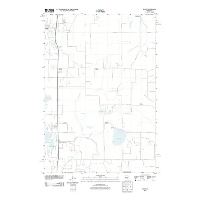
2010 Map of Isanti
USGS Topo · Published 2010About this map
Isanti sits at the northern edge of this Minnesota landscape, its residential grid centered around the Isanti Post Office and nearby Isanti Union Cemetery. The terrain is defined by a dense network of glacial lakes and wetlands, including the expansive Fish Lake and the ecologically significant Natural His Area U of M near Cedar Bog Lake. Rural life in this era is mapped through a high concentration of community landmarks, particularly family and church graveyards like Gerdins Cemetery, Old Bethel Cemetery, and Athens Cemetery which anchor the local intersections.
Find a feature on this map
67 named features on this map. Tap any name to fly to it.
Don’t see what you’re looking for? This feature index may not catch every label — zoom into the map to look around manually.
Map Details
Editions of this 2010 Isanti Map
This is the sole edition of this map. No revisions or reprints were ever made.
Other maps of this area

1916 · St. Francis
USGS Topo · 1:62,500

1919 · St. Francis
USGS Topo · 1:62,500

1953 · Stillwater
USGS Topo · 1:250,000

1955 · Isanti
USGS Topo · 1:62,500

1955 · Stillwater
USGS Topo · 1:250,000

1958 · Stillwater
USGS Topo · 1:250,000

1961 · Bradford
USGS Topo · 1:24,000

1961 · Cambridge
USGS Topo · 1:62,500

1961 · Dalbo
USGS Topo · 1:62,500

1965 · Stillwater
USGS Topo · 1:250,000