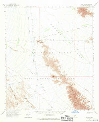
1965 Map of Isla Pinta
USGS Topo · Published 1970About this map
Sierra Pinta and the Mohawk Mountains dominate this arid landscape within the Cabeza Prieta Game Range and the adjacent Luke Air Force Range. The map documents a critical network of water sources essential for survival in this desert environment, including Isla Pinta, North Pinta Tank, and Senora Tank. The land is characterized by dramatic topographic features like Point of the Pintas and deep incisions such as What Fo Canyon and Chia Canyon. Traces of human activity are sparse but significant, marked by the Dry Well Corral near the Luke Air Force Range Boundary and scattered Jeep Trails. Travel through the mountains is facilitated by traditional routes like Bean Pass, Sunday Pass, and Christmas Pass, while the broad Mohawk Valley and Tule Desert provide the connective floor between the ranges.
Find a feature on this map
28 named features on this map. Tap any name to fly to it.
Don’t see what you’re looking for? This feature index may not catch every label — zoom into the map to look around manually.
Map Details
Editions of this 1965 Isla Pinta Map
2 editions found

Other maps of this area

1926 · Mohawk
USGS Topo · 1:62,500

1927 · Aguila Mountains
USGS Topo · 1:48,000

1927 · Kim
USGS Topo · 1:62,500

1928 · Mohawk
USGS Topo · 1:62,500

1930 · Aguila Mountains
USGS Topo · 1:62,500

1931 · Kim
USGS Topo · 1:62,500

1953 · Ajo
USGS Topo · 1:250,000

1957 · Ajo
USGS Topo · 1:250,000

1958 · Ajo
USGS Topo · 1:250,000

1962 · Ajo
USGS Topo · 1:250,000