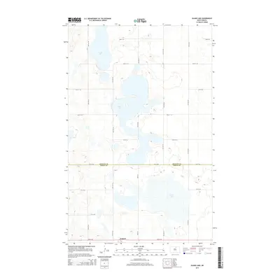
2014 Map of Island Lake
USGS Topo · Published 2014About this map
Wolford stands at the southern edge of this North Dakota landscape, situated along the border of Pierce Co and Rolette Co. The area is defined by a significant wetland and lake system characteristic of the prairie pothole region, where water bodies like Island Lake and the marshy expanse of Grass Lake dominate the terrain. These lakes are connected by a rigid grid of section-line roads, including Knox Rd and numerous numbered avenues and streets that reveal the enduring influence of the Public Land Survey System on the local geography. Further north, the landscape includes Long Lake and Twin Lakes, illustrating the seasonal and hydrologic variability of the region. This 2014 survey documents the modern rural infrastructure and water distribution in a sparsely populated agricultural environment, showing how the local road network navigates the expansive basins and shorelines.
Find a feature on this map
21 named features on this map. Tap any name to fly to it.
Don’t see what you’re looking for? This feature index may not catch every label — zoom into the map to look around manually.
Map Details
Editions of this 2014 Island Lake Map
This is the sole edition of this map. No revisions or reprints were ever made.
Other maps of this area

1953 · Devils Lake
USGS Topo · 1:250,000

1956 · Devils Lake
USGS Topo · 1:250,000

1971 · Wolford
USGS Topo · 1:24,000

1971 · Island Lake
USGS Topo · 1:24,000

1971 · Rugby NE
USGS Topo · 1:24,000

1971 · Mylo
USGS Topo · 1:24,000

1971 · Hurricane Lake West
USGS Topo · 1:24,000

1971 · Mylo NW
USGS Topo · 1:24,000
1971 · Rolette
USGS Topo · 1:24,000

1971 · Mylo SE
USGS Topo · 1:24,000