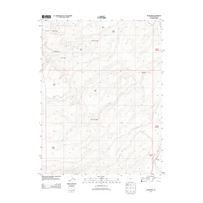
2013 Map of Island Mesa
USGS Topo · Published 2013About this map
Island Mesa stands as the central topographic feature in this high-desert portion of Mesa County, defined by a complex network of drainage systems and plateau landforms. The landscape is carved by significant erosional features such as Billings Canyon, Bangs Canyon, and the dramatic Hells Hole. Access to this high country is marked by Little Park Rd in the north and Co-141 cutting through the southeastern corner near Ninemile Hill. Several seasonal or permanent water sources are identified, including End Spring and Notch Spring, which historically served as vital points for livestock and wildlife in this arid environment. The map details the transition from the level expanse of Horse Mesa and Clarks Bench into the deep incision of Unaweep Canyon, illustrating the varied elevations and geological strata characteristic of the Western Slope.
Find a feature on this map
22 named features on this map. Tap any name to fly to it.
Don’t see what you’re looking for? This feature index may not catch every label — zoom into the map to look around manually.
Map Details
Editions of this 2013 Island Mesa Map
This is the sole edition of this map. No revisions or reprints were ever made.
Other maps of this area
1934 · Colorado National Monument
USGS Topo · 1:24,000
1956 · Moab
USGS Topo · 1:250,000

1956 · Grand Junction
USGS Topo · 1:250,000

1959 · Grand Junction
USGS Topo · 1:250,000
1959 · Moab
USGS Topo · 1:250,000
1960 · Moab
USGS Topo · 1:250,000

1960 · Grand Junction
USGS Topo · 1:250,000
1962 · Moab
USGS Topo · 1:250,000
1962 · Grand Junction
USGS Topo · 1:250,000
1962 · Clifton
USGS Topo · 1:24,000