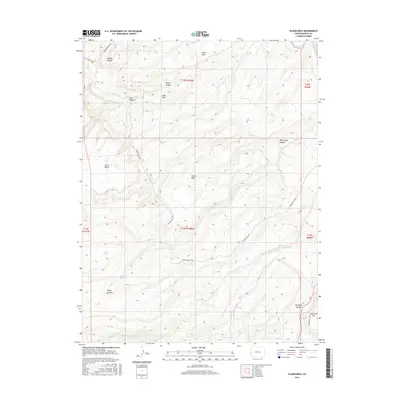
2016 Map of Island Mesa
USGS Topo · Published 2016About this map
Island Mesa stands as a central topographic feature in this high-desert portion of Mesa County, characterized by a complex network of deep drainage basins and prominent plateaus. The landscape is defined by its seasonal water sources, including Notch Spring, End Spring, and Corduroy Spring, which provided essential hydration for travelers and livestock in this arid environment. The northeastern corner is bounded by the Gunnison River, while the southern reaches are dominated by the significant gorge of Unaweep Canyon. The historic Tabeguache Trail winds extensively through the quadrangle, following the natural contours of the land from Ninemile Hill across the mesa tops. This route, alongside secondary landmarks like Hells Hole and Billings Canyon, illustrates the long-standing importance of this area for transit and access to the higher country west of the river. The presence of Little Park Rd in the northwest marks the primary modern entry point into this terrain of benches and canyons.
Find a feature on this map
24 named features on this map. Tap any name to fly to it.
Don’t see what you’re looking for? This feature index may not catch every label — zoom into the map to look around manually.
Map Details
Editions of this 2016 Island Mesa Map
This is the sole edition of this map. No revisions or reprints were ever made.
Other maps of this area
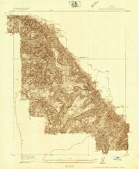
1934 · Colorado National Monument
USGS Topo · 1:24,000
1956 · Moab
USGS Topo · 1:250,000

1956 · Grand Junction
USGS Topo · 1:250,000

1959 · Grand Junction
USGS Topo · 1:250,000
1959 · Moab
USGS Topo · 1:250,000
1960 · Moab
USGS Topo · 1:250,000

1960 · Grand Junction
USGS Topo · 1:250,000
1962 · Moab
USGS Topo · 1:250,000
1962 · Grand Junction
USGS Topo · 1:250,000
1962 · Clifton
USGS Topo · 1:24,000