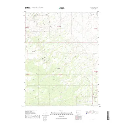
2019 Map of Island Mesa
USGS Topo · Published 2019About this map
Island Mesa stands as the central topographic feature of this high-plateau landscape, where dramatic elevation changes define the local geography. To the northeast, the Gunnison River carves through the terrain, while the deep incisions of Bangs Canyon and West Bangs Canyon reach toward the interior. The map illustrates a complex network of drainage systems and natural springs, such as End Spring, Notch Spring, and Corduroy Spring, which have historically been vital water sources in this arid environment.
Find a feature on this map
26 named features on this map. Tap any name to fly to it.
Don’t see what you’re looking for? This feature index may not catch every label — zoom into the map to look around manually.
Map Details
Editions of this 2019 Island Mesa Map
This is the sole edition of this map. No revisions or reprints were ever made.
Other maps of this area
1934 · Colorado National Monument
USGS Topo · 1:24,000
1956 · Moab
USGS Topo · 1:250,000

1956 · Grand Junction
USGS Topo · 1:250,000

1959 · Grand Junction
USGS Topo · 1:250,000
1959 · Moab
USGS Topo · 1:250,000
1960 · Moab
USGS Topo · 1:250,000

1960 · Grand Junction
USGS Topo · 1:250,000
1962 · Moab
USGS Topo · 1:250,000
1962 · Grand Junction
USGS Topo · 1:250,000
1962 · Clifton
USGS Topo · 1:24,000