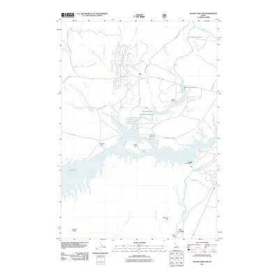
2011 Map of Island Park Dam
USGS Topo · Published 2011About this map
Island Park Reservoir dominates this high-country Idaho landscape, where the Henrys Fork river is captured at the Island Park Dam. The geography here is defined by its recreation and ranching heritage, with a network of access points like Jackson Landing Campground and Buttermilk Campground dotting the shoreline. To the north, the small settlement of Rea and the McCrea Ranch sit along the winding river valley below Thurmon Ridge. The map details a complex system of local forest roads, including Yale-Kilgore Rd and Stamp Meadows Rd, which connect the scattered homesteads and seasonal camps. Diverse terrain features such as I P Bills Island, Shotgun Valley, and the dramatic Box Canyon illustrate the unique volcanic and alluvial geology of the Snake River Plain’s northern edge in the early 21st century.
Find a feature on this map
43 named features on this map. Tap any name to fly to it.
Don’t see what you’re looking for? This feature index may not catch every label — zoom into the map to look around manually.
Map Details
Editions of this 2011 Island Park Dam Map
This is the sole edition of this map. No revisions or reprints were ever made.
Other maps of this area

1950 · Upper Red Rock Lake
USGS Topo · 1:62,500

1955 · Ashton
USGS Topo · 1:250,000

1958 · Ashton
USGS Topo · 1:250,000

1960 · Ashton
USGS Topo · 1:250,000

1964 · Hatchery Butte
USGS Topo · 1:24,000

1964 · Island Park
USGS Topo · 1:24,000

1964 · Island Park Dam
USGS Topo · 1:24,000

1964 · Sawtell PK
USGS Topo · 1:24,000

1964 · Big Springs
USGS Topo · 1:24,000

1964 · Last Chance
USGS Topo · 1:24,000