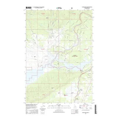
2017 Map of Island Park Dam
USGS Topo · Published 2017About this map
Island Park Reservoir and the Island Park Dam anchor this landscape, where the waters of the Henrys Fork collect before continuing through the Henrys Fork Caldera. The map documents a complex recreational and residential layout, particularly on I P Bills Island and along the various loops and landings like Jackson Landing that serve the shoreline. To the north, the terrain rises into the Centennial Mountains, feeding numerous creeks including Yale Cr and Sugar Creek into the basin.
Find a feature on this map
97 named features on this map. Tap any name to fly to it.
Don’t see what you’re looking for? This feature index may not catch every label — zoom into the map to look around manually.
Map Details
Editions of this 2017 Island Park Dam Map
This is the sole edition of this map. No revisions or reprints were ever made.
Other maps of this area

1950 · Upper Red Rock Lake
USGS Topo · 1:62,500

1955 · Ashton
USGS Topo · 1:250,000

1958 · Ashton
USGS Topo · 1:250,000

1960 · Ashton
USGS Topo · 1:250,000

1964 · Hatchery Butte
USGS Topo · 1:24,000

1964 · Island Park
USGS Topo · 1:24,000

1964 · Island Park Dam
USGS Topo · 1:24,000

1964 · Sawtell PK
USGS Topo · 1:24,000

1964 · Big Springs
USGS Topo · 1:24,000

1964 · Last Chance
USGS Topo · 1:24,000