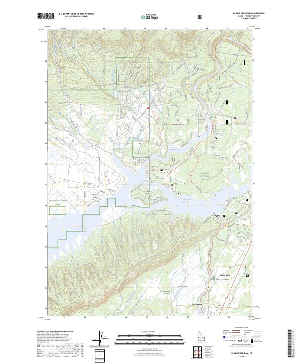
2024 Map of Island Park Dam
USGS Topo · Published 2024About this map
Island Park Reservoir dominates the landscape of this portion of Targhee National Forest, where the waters of the Henrys Fork are held by the Island Park Dam. The geography here is defined by immense volcanic features, including the Island Park Caldera and the Henrys Fork Caldera, illustrating the complex geological heritage of Fremont County. To the north, the Eastern Centennial Mountains rise above the basin, with drainage through Sugar Creek and Mill Creek. Local settlement and recreation are centered around Island Park and residential areas like I P Bills Island. Tracing the varied road networks, such as Kilgore Yale Rd and Old Shotgun Rd, reveals the transition from valley floor to the high terrain of Thurman Ridge and the Centennial Mountains.
Find a feature on this map
104 named features on this map. Tap any name to fly to it.
Don’t see what you’re looking for? This feature index may not catch every label — zoom into the map to look around manually.
Map Details
Editions of this 2024 Island Park Dam Map
This is the sole edition of this map. No revisions or reprints were ever made.
Other maps of this area

1950 · Upper Red Rock Lake
USGS Topo · 1:62,500

1955 · Ashton
USGS Topo · 1:250,000

1958 · Ashton
USGS Topo · 1:250,000

1960 · Ashton
USGS Topo · 1:250,000

1964 · Hatchery Butte
USGS Topo · 1:24,000

1964 · Island Park
USGS Topo · 1:24,000

1964 · Island Park Dam
USGS Topo · 1:24,000

1964 · Sawtell PK
USGS Topo · 1:24,000

1964 · Big Springs
USGS Topo · 1:24,000

1964 · Last Chance
USGS Topo · 1:24,000