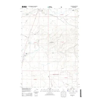
2013 Map of Island Park
USGS Topo · Published 2013About this map
Island Park serves as a central point for this 2013 survey of the high-altitude landscape within the Targhee National Forest. The map documents a corridor of settlement and recreation along Us HWY 20, following the path of Henrys Fork and the Buffalo River. Notable residential and seasonal locations include Trude, Flat Rock, and Elk Creek Ranch. The presence of Island Park Siding in the south and the Trude Snowmobile Trail Rd highlights the area's dual history of rail-era transport and modern outdoor tourism. Extensive water systems are detailed, from the headwaters at Big Springs to the numerous drainages like Toms Creek and Moose Creek that feed into the larger river basins. Recreational development is anchored by the Upper Coffee Pot Campground and Buffalo Campground, which flank the waterways in the western half of the quadrangle.
Find a feature on this map
46 named features on this map. Tap any name to fly to it.
Don’t see what you’re looking for? This feature index may not catch every label — zoom into the map to look around manually.
Map Details
Editions of this 2013 Island Park Map
This is the sole edition of this map. No revisions or reprints were ever made.
Other maps of this area

1955 · Ashton
USGS Topo · 1:250,000

1957 · Buffalo Lake
USGS Topo · 1:62,500

1958 · Ashton
USGS Topo · 1:250,000

1958 · West Yellowstone
USGS Topo · 1:62,500

1960 · Ashton
USGS Topo · 1:250,000

1964 · Hatchery Butte
USGS Topo · 1:24,000

1964 · Island Park
USGS Topo · 1:24,000

1964 · Island Park Dam
USGS Topo · 1:24,000

1964 · Sawtell PK
USGS Topo · 1:24,000

1964 · Big Springs
USGS Topo · 1:24,000