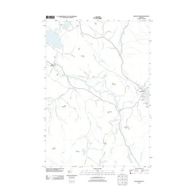
2012 Map of Island Pond
USGS Topo · Published 2012About this map
Island Pond serves as a focal point for this Northeastern Vermont landscape, where the Clyde River and Pherrins River drain a complex network of glacial ponds and mountain brooks. The settlement patterns reflect a legacy of local community life, with numerous family and denominational burial grounds including Old Protestant Cem, Old Catholic Cem, and the Lakeside Cem. To the west, the village of East Charleston sits along the riverbanks, connected by early routes like Twin Bridges Rd and Church Hill Rd. The terrain is defined by prominent peaks such as Dolif Mountain, Job Mountain, and Bald Mountain, which overlook a series of smaller water bodies like Seymour Lake and Jobs Pond. For researchers, the map documents the concentration of civic life around the railroad-influenced village of Island Pond while also preserving the names of more isolated rural locales like Little Hedgehog and Bear Hill.
Find a feature on this map
101 named features on this map. Tap any name to fly to it.
Don’t see what you’re looking for? This feature index may not catch every label — zoom into the map to look around manually.
Map Details
Editions of this 2012 Island Pond Map
This is the sole edition of this map. No revisions or reprints were ever made.
Other maps of this area

1919 · Lake Memphremagog
USGS Topo · 1:62,500

1920 · Derby
USGS Topo · 1:62,500

1923 · Lake Memphremagog
USGS Topo · 1:48,000

1924 · Island Pond
USGS Topo · 1:48,000

1925 · Memphremagog
USGS Topo · 1:62,500

1926 · Island Pond
USGS Topo · 1:62,500

1935 · Lyndonville
USGS Topo · 1:48,000

1939 · Lyndonville
USGS Topo · 1:62,500

1950 · Lake Champlain
USGS Topo · 1:250,000

1950 · Lewiston
USGS Topo · 1:250,000