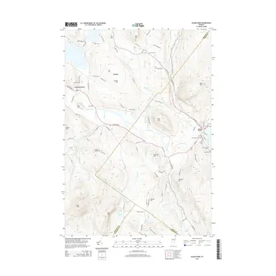
2015 Map of Island Pond
USGS Topo · Published 2015About this map
Island Pond serves as a central hub for this corner of the Northeast Kingdom, where the village is defined by its namesake water body and the proximity of the Clyde River. The town layout in this era shows a high concentration of burial grounds, including the Old Protestant Cem, Old Catholic Cem, and Lakeside Cem, which offer significant data for genealogical research. To the west, the village of East Charleston sits along the river, surrounded by a landscape of family-named peaks such as Hopkins Hill and Meehan Hill. The drainage patterns are intricate, with numerous brooks like Buck Brook and Mad Brook feeding into larger systems, while the presence of the Orleans Co Essex Co line indicates the administrative boundaries that have shaped local governance. This survey reflects a region where the rugged topography of Bald Mtn and Dolif Mtn dictates the winding paths of rural roads like 10 Mile Square Rd.
Find a feature on this map
103 named features on this map. Tap any name to fly to it.
Don’t see what you’re looking for? This feature index may not catch every label — zoom into the map to look around manually.
Map Details
Editions of this 2015 Island Pond Map
This is the sole edition of this map. No revisions or reprints were ever made.
Other maps of this area

1919 · Lake Memphremagog
USGS Topo · 1:62,500

1920 · Derby
USGS Topo · 1:62,500

1923 · Lake Memphremagog
USGS Topo · 1:48,000

1924 · Island Pond
USGS Topo · 1:48,000

1925 · Memphremagog
USGS Topo · 1:62,500

1926 · Island Pond
USGS Topo · 1:62,500

1935 · Lyndonville
USGS Topo · 1:48,000

1939 · Lyndonville
USGS Topo · 1:62,500

1950 · Lake Champlain
USGS Topo · 1:250,000

1950 · Lewiston
USGS Topo · 1:250,000