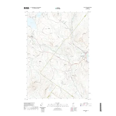
2021 Map of Island Pond
USGS Topo · Published 2021About this map
Island Pond serves as the primary hub for this corner of the Northeast Kingdom, where the waters of the Clyde River begin their westward journey. The settlement is anchored by a significant collection of burial grounds reflecting the town’s communal history, including the Old Protestant Cem, Old Catholic Cem, and New Catholic Cem. Further west, the village of East Charleston sits between Echo Lake and Seymour Lake, connected by a network of local roads such as Ten Mile Square Rd and Hinton Hill Rd. The landscape is defined by its dramatic relief, rising from the river lowlands to prominent summits like Bluff Mtn and Haystack Hill. Genealogists and local historians will find value in the dispersed markers of early settlement, such as Frenchmans Lot and various family-named sites like Buck Cem and Morrill Cem, which remain scattered across the highlands and timbered slopes of the Orleans and Essex county lines.
Find a feature on this map
109 named features on this map. Tap any name to fly to it.
Don’t see what you’re looking for? This feature index may not catch every label — zoom into the map to look around manually.
Map Details
Editions of this 2021 Island Pond Map
This is the sole edition of this map. No revisions or reprints were ever made.
Other maps of this area

1919 · Lake Memphremagog
USGS Topo · 1:62,500

1920 · Derby
USGS Topo · 1:62,500

1923 · Lake Memphremagog
USGS Topo · 1:48,000

1924 · Island Pond
USGS Topo · 1:48,000

1925 · Memphremagog
USGS Topo · 1:62,500

1926 · Island Pond
USGS Topo · 1:62,500

1935 · Lyndonville
USGS Topo · 1:48,000

1939 · Lyndonville
USGS Topo · 1:62,500

1950 · Lake Champlain
USGS Topo · 1:250,000

1950 · Lewiston
USGS Topo · 1:250,000