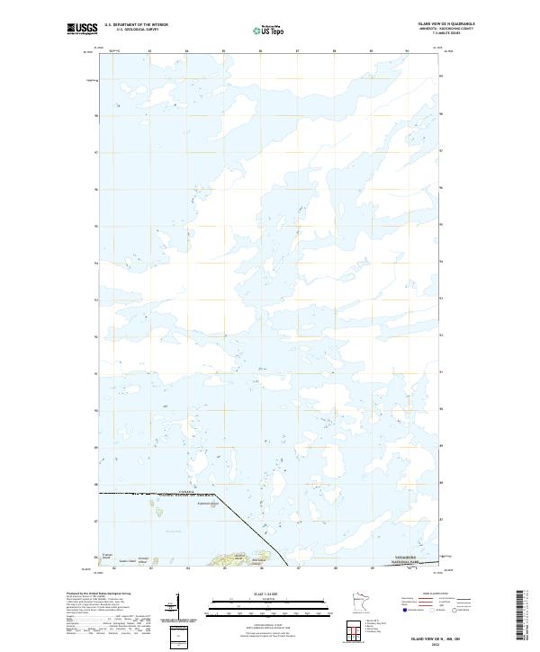
2022 Map of Island View OE N
USGS Topo · Published 2022About this map
Rainy Lake dominates this northern frontier, where the international boundary between the United States and Canada threads through an intricate network of waterways and islands. This 2022 survey captures the northern reaches of Voyageurs National Park, a landscape defined more by water than by land. The distribution of named islands, such as Eightmile Island and Jackfish Island, suggests a topography shaped by glacial history, where only the highest points of the Canadian Shield rise above the water level. The absence of roads or established settlements on this sheet reflects the protected and primitive character of the borderlands. Smaller features like Red Sucker Island and Fransen Island punctuate the vast expanse of the lake, serving as critical landmarks for navigation in a region where the water serves as the primary thoroughfare.
Find a feature on this map
11 named features on this map. Tap any name to fly to it.
Don’t see what you’re looking for? This feature index may not catch every label — zoom into the map to look around manually.
Map Details
Editions of this 2022 Island View OE N Map
This is the sole edition of this map. No revisions or reprints were ever made.
Other maps of this area

1919 · International Falls
USGS Topo · 1:62,500

1954 · International Falls
USGS Topo · 1:250,000

1957 · International Falls
USGS Topo · 1:250,000

1958 · International Falls
USGS Topo · 1:250,000

1963 · Ranier
USGS Topo · 1:24,000

1969 · Island View
USGS Topo · 1:24,000

1969 · Cranberry Bay
USGS Topo · 1:24,000

1969 · Ranier
USGS Topo · 1:24,000
1978 · International Falls
USGS Topo · 1:100,000
1999 · Cranberry Bay
USGS Topo · 1:24,000