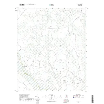
2020 Map of Islandton
USGS Topo · Published 2020About this map
Islandton serves as the primary settlement hub in this South Carolina Lowcountry landscape, situated at the junction of Snyder Hwy and Lodge Hwy. The area's topography is defined by the convergence of the Salkehatchie River and the Little Salkehatchie River along the southern and eastern borders. For genealogists, the map reveals a network of rural burial grounds including Rice Path Cem, Cross Swamp Cem, and Adnah Cem, which provide clues to the region's historical family lineages. The terrain is characterized by extensive wetlands such as Moselle Swamp, Cross Swamp, and Willow Swamp, through which numerous creeks like Ricepatch Cr and Deep Cr flow. Significant elevations are noted along the riverbanks, specifically at Toby Bluff and Tobys Bluff, marking the high ground above the swampy floodplain. The road network, including Ashton Rd and Murdaugh Ave, reflects a rural development pattern influenced by the local drainage systems and river valleys.
Find a feature on this map
59 named features on this map. Tap any name to fly to it.
Don’t see what you’re looking for? This feature index may not catch every label — zoom into the map to look around manually.
Map Details
Editions of this 2020 Islandton Map
This is the sole edition of this map. No revisions or reprints were ever made.
Other maps of this area

1918 · Varnville
USGS Topo · 1:62,500

1919 · Olar
USGS Topo · 1:62,500

1919 · Cummings
USGS Topo · 1:62,500

1919 · Lodge
USGS Topo · 1:62,500

1920 · Lodge
USGS Topo · 1:48,000

1921 · Lodge
USGS Topo · 1:62,500

1943 · Olar
USGS Topo · 1:62,500

1943 · Lodge
USGS Topo · 1:62,500

1943 · Orangeburg
USGS Topo · 1:125,000

1943 · Cummings
USGS Topo · 1:62,500