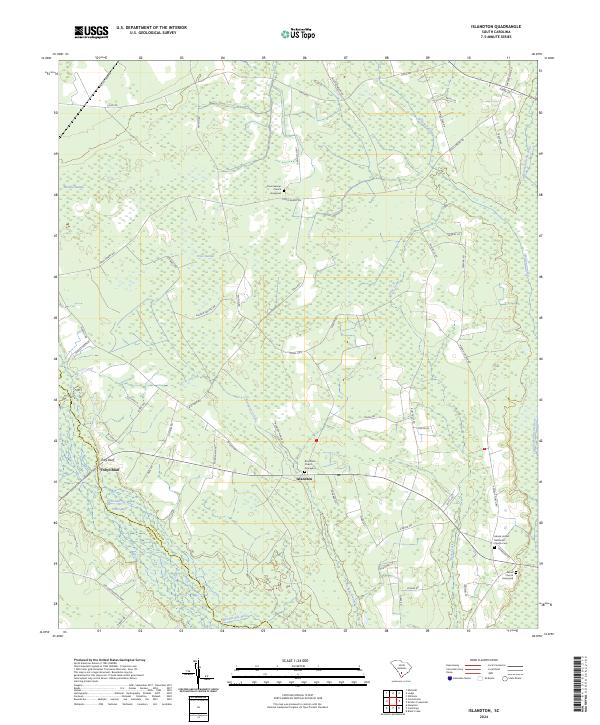
2024 Map of Islandton
USGS Topo · Published 2024About this map
The settlement of Islandton serves as the focal point for this Lowcountry landscape, situated where the Salkehatchie River and Little Salkehatchie River systems converge. The map illustrates a region defined by extensive hydraulic networks, including Moselle Swamp and Cross Swamp, which dictate the placement of early roads and small communities. These waterways have historically shaped the local geography, with landmarks like Toby Bluff rising above the riverbanks.
Find a feature on this map
65 named features on this map. Tap any name to fly to it.
Don’t see what you’re looking for? This feature index may not catch every label — zoom into the map to look around manually.
Map Details
Editions of this 2024 Islandton Map
This is the sole edition of this map. No revisions or reprints were ever made.
Other maps of this area

1918 · Varnville
USGS Topo · 1:62,500

1919 · Olar
USGS Topo · 1:62,500

1919 · Cummings
USGS Topo · 1:62,500

1919 · Lodge
USGS Topo · 1:62,500

1920 · Lodge
USGS Topo · 1:48,000

1921 · Lodge
USGS Topo · 1:62,500

1943 · Olar
USGS Topo · 1:62,500

1943 · Lodge
USGS Topo · 1:62,500

1943 · Orangeburg
USGS Topo · 1:125,000

1943 · Cummings
USGS Topo · 1:62,500