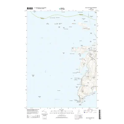
2014 Map of Isle Au Haut West
USGS Topo · Published 2014About this map
Acadia National Park dominates the southeastern coastline of this island landscape, where the granite ridges of Wentworth Mtn and Duck Harbor Mtn overlook the Atlantic Ocean. The settlement of Isle Au Haut serves as the primary hub, connected by the coastal Main Rd and Lighthouse Rd. The map reveals a complex maritime environment defined by the Isle Au Haut Thorofare and the island-studded waters of Merchant Row. Genealogical details are preserved in sites like Turners Cem and Duck Harbor Cem, while the outlying Merchant Island maintains its own distinct history with the Merchant Island Cem. The western reaches extend into East Penobscot Bay, showing the numerous ledges and rocks such as Scraggy Ledge and The Brown Cow that have long challenged local navigation.
Find a feature on this map
79 named features on this map. Tap any name to fly to it.
Don’t see what you’re looking for? This feature index may not catch every label — zoom into the map to look around manually.
Map Details
Editions of this 2014 Isle Au Haut West Map
This is the sole edition of this map. No revisions or reprints were ever made.
Other maps of this area

1904 · Deer Isle
USGS Topo · 1:62,500

1904 · Vinalhaven
USGS Topo · 1:62,500

1905 · Penobscot Bay
USGS Topo · 1:125,000

1906 · Matinicus
USGS Topo · 1:62,500

1941 · Vinalhaven
USGS Topo · 1:62,500

1942 · Deer Isle
USGS Topo · 1:62,500

1944 · Vinalhaven
USGS Topo · 1:62,500

1944 · Deer Isle
USGS Topo · 1:62,500

1948 · Bangor
USGS Topo · 1:250,000

1948 · Bath
USGS Topo · 1:250,000