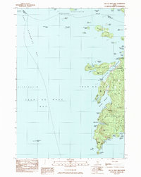
1983 Map of Isle Au Haut West
USGS Topo · Published 1983About this map
Isle Au Haut and its surrounding archipelago define the eastern edge of East Penobscot Bay in this early 1980s survey. The map details the intricate island landscape of Merchant Row, where numerous smaller landmasses like Merchant Island and Harbor Island create a complex navigation route through the Isle Au Haut Bay. On the main island, the village of Isle Au Haut is clustered near the Isle Au Haut Thorofare, supported by local landmarks such as Turners Cem and the Robinson Point Lighthouse.
Find a feature on this map
69 named features on this map. Tap any name to fly to it.
Don’t see what you’re looking for? This feature index may not catch every label — zoom into the map to look around manually.
Map Details
Editions of this 1983 Isle Au Haut West Map
This is the sole edition of this map. No revisions or reprints were ever made.
Other maps of this area

1904 · Deer Isle
USGS Topo · 1:62,500

1904 · Vinalhaven
USGS Topo · 1:62,500

1905 · Penobscot Bay
USGS Topo · 1:125,000

1906 · Matinicus
USGS Topo · 1:62,500

1941 · Vinalhaven
USGS Topo · 1:62,500

1942 · Deer Isle
USGS Topo · 1:62,500

1944 · Vinalhaven
USGS Topo · 1:62,500

1944 · Deer Isle
USGS Topo · 1:62,500

1948 · Bangor
USGS Topo · 1:250,000

1948 · Bath
USGS Topo · 1:250,000