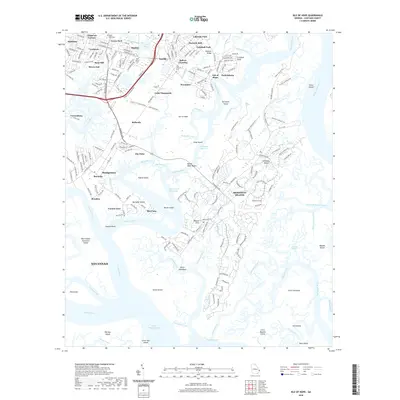
2020 Map of Isle of Hope
USGS Topo · Published 2020About this map
The Skidaway River and Vernon River carve a complex network of marshes and hammocks south of Savannah, defining the coastal character of this Chatham County landscape. Residential communities like Isle of Hope and Sandfly occupy the higher ground between the tidal creeks, while the expansive Skidaway Island dominates the eastern portion of the map. Genealogical and historic sites are scattered throughout, including the Old Church Cem near Bakers Crossing and the New Guinea Cem in Mayfair. The inclusion of Wormsloe and the community of Pin Point reflects the deep cultural roots of this tidewater region. To the south, the terrain dissolves into the Romerly Marshes and a series of hammocks such as Ritter Hammock and Flora Hammock, illustrating the transition from established suburban settlements to the undeveloped barrier island ecosystems of the Sea Islands.
Find a feature on this map
88 named features on this map. Tap any name to fly to it.
Don’t see what you’re looking for? This feature index may not catch every label — zoom into the map to look around manually.
Map Details
Editions of this 2020 Isle of Hope Map
This is the sole edition of this map. No revisions or reprints were ever made.
Other maps of this area

1920 · Wassaw Sound
USGS Topo · 1:62,500

1920 · Bluffton
USGS Topo · 1:62,500

1942 · Savannah
USGS Topo · 1:62,500

1944 · Ossabaw Island
USGS Topo · 1:62,500

1945 · Bluffton
USGS Topo · 1:62,500

1945 · Ossabaw Island
USGS Topo · 1:62,500

1945 · Wassaw Sound
USGS Topo · 1:62,500

1946 · Brunswick
USGS Topo · 1:250,000

1947 · Savannah
USGS Topo · 1:250,000

1948 · Brunswick
USGS Topo · 1:250,000