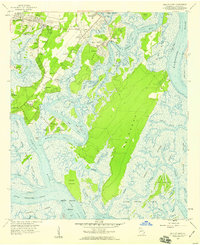
1957 Map of Isle of Hope
USGS Topo · Published 1959About this map
Isle of Hope and the surrounding coastal islands define this 1957 landscape, where the tides of the Wilmington River and Skidaway River carve through a network of salt marshes. The map reveals established shoreline communities like Pin Point, Beaulieu, and Montgomery, connected by local arteries such as Skidaway Road and Ferguson Avenue. Land use here reflects a long history of institutional and agricultural presence, evidenced by the St Thomas Boys Home, the Water Orphanage at Bethesda, and the storied Wormsloe estate.
Find a feature on this map
94 named features on this map. Tap any name to fly to it.
Don’t see what you’re looking for? This feature index may not catch every label — zoom into the map to look around manually.
Map Details
Editions of this 1957 Isle of Hope Map
2 editions found
Other maps of this area

1920 · Wassaw Sound
USGS Topo · 1:62,500

1920 · Bluffton
USGS Topo · 1:62,500

1942 · Savannah
USGS Topo · 1:62,500

1944 · Ossabaw Island
USGS Topo · 1:62,500

1945 · Bluffton
USGS Topo · 1:62,500

1945 · Ossabaw Island
USGS Topo · 1:62,500

1945 · Wassaw Sound
USGS Topo · 1:62,500

1946 · Brunswick
USGS Topo · 1:250,000

1947 · Savannah
USGS Topo · 1:250,000

1948 · Brunswick
USGS Topo · 1:250,000