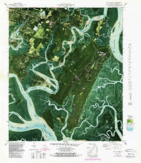
1979 Map of Isle of Hope
USGS Topo · Published 1988About this map
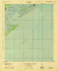
Isle of Hope and the surrounding coastal marshlands of Chatham County appear here in a transition period of late-twentieth-century development. The map detail highlights established communities like Wymberly and Parkersburg alongside historical institutions such as the Bethesda Home for Boys. This orthophotomap combines aerial photography with topographic data to show the intricate network of the Intracoastal Waterway and the Skidaway River as they carve through Dutch Island and Wilmington Island.
Find a feature on this map
68 named features on this map. Tap any name to fly to it.
Don’t see what you’re looking for? This feature index may not catch every label — zoom into the map to look around manually.
Map Details
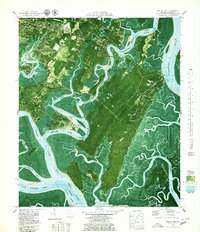
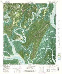
Editions of this 1979 Isle of Hope Map
3 editions found
Other maps of this area
1920 · Wassaw Sound
USGS Topo · 1:62,500

1920 · Bluffton
USGS Topo · 1:62,500

1942 · Savannah
USGS Topo · 1:62,500

1944 · Ossabaw Island
USGS Topo · 1:62,500

1945 · Bluffton
USGS Topo · 1:62,500

1945 · Ossabaw Island
USGS Topo · 1:62,500
1945 · Wassaw Sound
USGS Topo · 1:62,500

1946 · Brunswick
USGS Topo · 1:250,000

1947 · Savannah
USGS Topo · 1:250,000

1948 · Brunswick
USGS Topo · 1:250,000