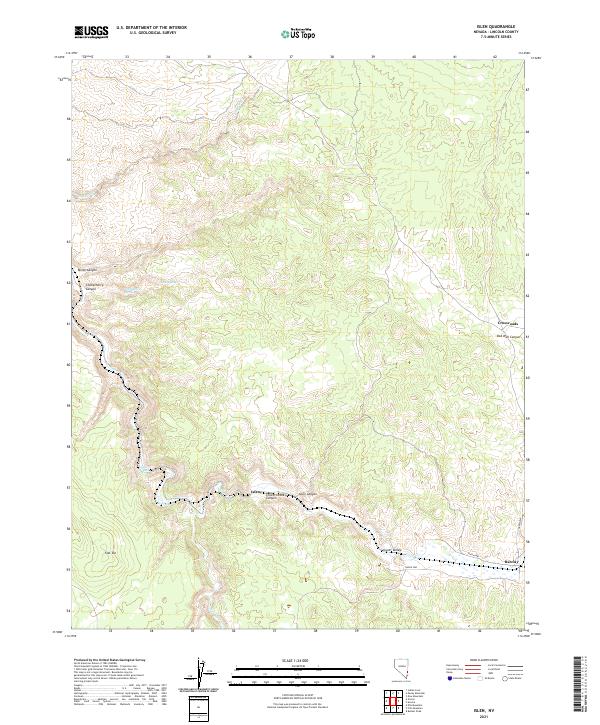
2021 Map of Islen
USGS Topo · Published 2021About this map
Islen and Barclay anchor the southern reaches of this Lincoln County survey, where the seasonal flow of Clover Cr carves through the expansive Clover Valley. The landscape is defined by the transition from high plateaus like Flat Top to the deep incisions of Islen Canyon and Clover Creek Canyon. Water sources are critical markers in this arid environment, with Big Spring, Little Spring, and Horse Spring providing essential points of interest for those tracing the historical movement of people and livestock through the basin and range province. At Crossroads, the map shows the convergence of routes near Oak Well Canyon, illustrating the sparse but deliberate connectivity of this region. Named washes like Empty Wash and Pine Wash further delineate the drainage patterns that have shaped the territory's geography and settlement history into the 21st century.
Find a feature on this map
22 named features on this map. Tap any name to fly to it.
Don’t see what you’re looking for? This feature index may not catch every label — zoom into the map to look around manually.
Map Details
Editions of this 2021 Islen Map
This is the sole edition of this map. No revisions or reprints were ever made.
Other maps of this area

1885 · Pioche
USGS Topo · 1:250,000

1886 · Pioche
USGS Topo · 1:250,000

1954 · Caliente
USGS Topo · 1:250,000

1959 · Caliente
USGS Topo · 1:250,000
1972 · Indian Cove
USGS Topo · 1:24,000
1972 · Mosey Mtn
USGS Topo · 1:24,000
1972 · Acoma
USGS Topo · 1:24,000
1972 · Eccles
USGS Topo · 1:24,000
1972 · Dow Mountain
USGS Topo · 1:24,000
1972 · Islen
USGS Topo · 1:24,000