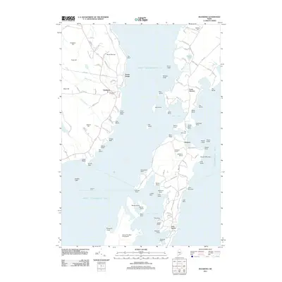
2011 Map of Islesboro
USGS Topo · Published 2011About this map
Islesboro island dominates this coastal survey, showcasing a landscape defined by maritime activity and summer colonies in the early 21st century. The map highlights the island's narrow geography, specifically at The Narrows, which separates the northern and southern halves of the community. In the south, the village of Dark Harbor and the Islesboro Airport indicate the area's role as a seasonal retreat, while the Islesboro Ferry provides a vital link across West Penobscot Bay to the mainland at Grindel Point. Along the western shore of the bay, the settlement of Northport and the Saturday Cove Cemetery offer points of interest for genealogists tracing local families. The terrain is marked by coastal elevations like Mount Percival and Beech Hill, which overlook a complex network of coves and ledges, including Barley Ledge and Hewes Ledge, illustrating the navigational challenges and natural beauty of the Maine coast.
Find a feature on this map
121 named features on this map. Tap any name to fly to it.
Don’t see what you’re looking for? This feature index may not catch every label — zoom into the map to look around manually.
Map Details
Editions of this 2011 Islesboro Map
This is the sole edition of this map. No revisions or reprints were ever made.
Other maps of this area

1902 · Castine
USGS Topo · 1:62,500

1904 · Castine
USGS Topo · 1:62,500

1904 · Vinalhaven
USGS Topo · 1:62,500

1904 · Rockland
USGS Topo · 1:62,500

1905 · Penobscot Bay
USGS Topo · 1:125,000

1906 · Rockland
USGS Topo · 1:62,500

1915 · Belfast
USGS Topo · 1:62,500

1917 · Belfast
USGS Topo · 1:62,500

1941 · Belfast
USGS Topo · 1:62,500

1941 · Rockland
USGS Topo · 1:62,500