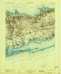
1904 Map of Islip
USGS Topo · Published 1930About this map
Long Island Sound and the Atlantic Ocean frame this detailed early 20th-century view of central Suffolk County, dominated by the established harbors of the north shore and the expanding rail networks of the interior. The landscape transitions from the high bluffs of Duck Island Bluff and the prominent Lloyd Neck down to the sprawling Great South Bay. The arrival of the Long Island Railroad with its Main Line and Montauk Division is clearly seen driving development in inland villages like Smithtown Branch and Brentwood.
Find a feature on this map
137 named features on this map. Tap any name to fly to it.
Don’t see what you’re looking for? This feature index may not catch every label — zoom into the map to look around manually.
Map Details
Editions of this 1904 Islip Map
5 editions found

Other maps of this area

1891 · Bridgeport
USGS Topo · 1:62,500

1892 · Stamford
USGS Topo · 1:62,500

1892 · Norwalk
USGS Topo · 1:62,500

1893 · Bridgeport
USGS Topo · 1:62,500

1893 · Stamford
USGS Topo · 1:62,500

1893 · Norwalk
USGS Topo · 1:62,500

1897 · Hempstead
USGS Topo · 1:62,500

1897 · Oyster Bay
USGS Topo · 1:62,500

1898 · Hempstead
USGS Topo · 1:62,500

1898 · Oyster Bay
USGS Topo · 1:62,500