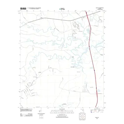
2012 Map of Italia
USGS Topo · Published 2012About this map
The Nassau River and its intricate network of tributaries, including Thomas Cr and Alligator Cr, dominate this coastal corridor of Northeast Florida. The landscape reflects a mix of institutional land use and small, river-oriented settlements such as Seaton Landing, Joels Landing, and Clay Landing. Further inland, the map shows the transition toward the transportation hubs and public facilities of northern Duval County, including the northern margins of Jacksonville International Airport and the Jacksonville Penal Farm. Genealogists and local historians will find the Jacksonville National Cem and the smaller Ogilvie Cem as significant points of interest. The area’s history is further grounded by local names like Italia and Hero, which sit alongside the meandering paths of Plummer Cr and Mills Cr.
Find a feature on this map
68 named features on this map. Tap any name to fly to it.
Don’t see what you’re looking for? This feature index may not catch every label — zoom into the map to look around manually.
Map Details
Editions of this 2012 Italia Map
This is the sole edition of this map. No revisions or reprints were ever made.
Other maps of this area

1917 · Cambon
USGS Topo · 1:62,500

1917 · Hilliard
USGS Topo · 1:62,500

1918 · St Marys
USGS Topo · 1:62,500

1918 · Cambon
USGS Topo · 1:62,500

1918 · Jacksonville
USGS Topo · 1:62,500

1919 · St Marys
USGS Topo · 1:62,500

1919 · Hilliard
USGS Topo · 1:62,500

1948 · Jacksonville
USGS Topo · 1:250,000

1948 · Eastport
USGS Topo · 1:24,000

1950 · Trout River
USGS Topo · 1:24,000