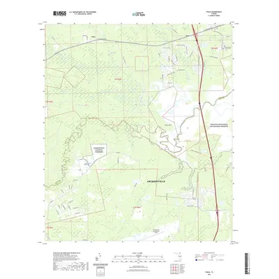
2021 Map of Italia
USGS Topo · Published 2021About this map
The Nassau River and its complex network of tributaries, including Thomas Creek and Seaton Creek, dominate this northern Florida landscape along the border of Nassau and Duval Counties. The area preserves significant green space and commemorative grounds, most notably the Jacksonville National Cemetery and a portion of the Timucuan Ecological and Historic Preserve. Small historic communities like Italia and Hero sit near the northern edge, reflecting the rural residential character that persists despite the proximity to the Jacksonville International Airport.
Find a feature on this map
69 named features on this map. Tap any name to fly to it.
Don’t see what you’re looking for? This feature index may not catch every label — zoom into the map to look around manually.
Map Details
Editions of this 2021 Italia Map
This is the sole edition of this map. No revisions or reprints were ever made.
Other maps of this area

1917 · Cambon
USGS Topo · 1:62,500

1917 · Hilliard
USGS Topo · 1:62,500

1918 · St Marys
USGS Topo · 1:62,500

1918 · Cambon
USGS Topo · 1:62,500

1918 · Jacksonville
USGS Topo · 1:62,500

1919 · St Marys
USGS Topo · 1:62,500

1919 · Hilliard
USGS Topo · 1:62,500

1948 · Jacksonville
USGS Topo · 1:250,000

1948 · Eastport
USGS Topo · 1:24,000

1950 · Trout River
USGS Topo · 1:24,000