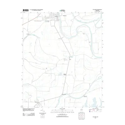
2012 Map of Itta Bena
USGS Topo · Published 2012About this map
Itta Bena anchors this portion of the Mississippi Delta, showing a landscape defined by the winding course of the Yazoo River and the significant oxbow formed by Roebuck Lake. The town's grid, featuring streets like N Carver St and Freedom St, reflects the local residential development near the Murphey Flying Service Airport. To the south, the terrain transitions into a patchwork of agricultural land and smaller settlements such as Quito, Sheppardtown, and Morgan City.
Find a feature on this map
78 named features on this map. Tap any name to fly to it.
Don’t see what you’re looking for? This feature index may not catch every label — zoom into the map to look around manually.
Map Details
Editions of this 2012 Itta Bena Map
This is the sole edition of this map. No revisions or reprints were ever made.
Other maps of this area

1931 · Schlater
USGS Topo · 1:48,000

1934 · Schlater
USGS Topo · 1:62,500

1936 · Greenwood
USGS Topo · 1:62,500

1939 · Schlater
USGS Topo · 1:62,500

1940 · Seven Pines
USGS Topo · 1:62,500

1940 · Greenwood
USGS Topo · 1:62,500

1953 · Greenwood
USGS Topo · 1:250,000

1956 · Greenwood
USGS Topo · 1:250,000

1957 · Greenwood
USGS Topo · 1:62,500

1957 · Seven Pines
USGS Topo · 1:62,500