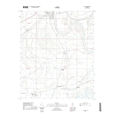
2018 Map of Itta Bena
USGS Topo · Published 2018About this map
Itta Bena serves as the primary hub in this Mississippi Delta landscape, where a dense network of county roads connects numerous small settlements and farming communities. The terrain is defined by the winding course of the Yazoo River and the intricate drainage of Pelucia Bayou, which together create a mosaic of wetlands and brakes like Gayden Brake and Mathis Brake. Local history is preserved in several rural burial grounds, including McIntyre Cem and Jeremiah Cem, which sit near the river's loops. The map also documents a series of established crossings and historic neighborhood sites such as Murdock Crossing, Sheppardtown, and Phillipstown. This contemporary survey details the enduring agricultural patterns and the specific street layouts of larger towns like Morgan City, providing a clear view of the region's modern settlement footprint.
Find a feature on this map
81 named features on this map. Tap any name to fly to it.
Don’t see what you’re looking for? This feature index may not catch every label — zoom into the map to look around manually.
Map Details
Editions of this 2018 Itta Bena Map
This is the sole edition of this map. No revisions or reprints were ever made.
Other maps of this area

1931 · Schlater
USGS Topo · 1:48,000

1934 · Schlater
USGS Topo · 1:62,500

1936 · Greenwood
USGS Topo · 1:62,500

1939 · Schlater
USGS Topo · 1:62,500

1940 · Seven Pines
USGS Topo · 1:62,500

1940 · Greenwood
USGS Topo · 1:62,500

1953 · Greenwood
USGS Topo · 1:250,000

1956 · Greenwood
USGS Topo · 1:250,000

1957 · Greenwood
USGS Topo · 1:62,500

1957 · Seven Pines
USGS Topo · 1:62,500