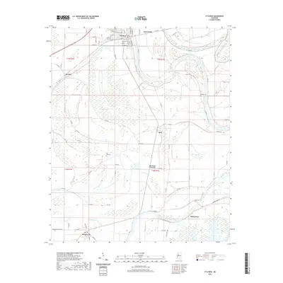
2020 Map of Itta Bena
USGS Topo · Published 2020About this map
The Yazoo River winds through the heart of this Mississippi Delta landscape, defining a terrain shaped by water and agriculture. The primary settlement of Itta Bena sits in the northern section, with its detailed street grid including Martin Luther King Jr Dr, Freedom St, and Lakeside Rd. This region is characterized by numerous brakes and lakes, such as Gaudet Brake, Fry Brake, and Mosquito Lake, which represent the shifting hydrology of the Delta over time.
Find a feature on this map
79 named features on this map. Tap any name to fly to it.
Don’t see what you’re looking for? This feature index may not catch every label — zoom into the map to look around manually.
Map Details
Editions of this 2020 Itta Bena Map
This is the sole edition of this map. No revisions or reprints were ever made.
Other maps of this area

1931 · Schlater
USGS Topo · 1:48,000

1934 · Schlater
USGS Topo · 1:62,500

1936 · Greenwood
USGS Topo · 1:62,500

1939 · Schlater
USGS Topo · 1:62,500

1940 · Seven Pines
USGS Topo · 1:62,500

1940 · Greenwood
USGS Topo · 1:62,500

1953 · Greenwood
USGS Topo · 1:250,000

1956 · Greenwood
USGS Topo · 1:250,000

1957 · Greenwood
USGS Topo · 1:62,500

1957 · Seven Pines
USGS Topo · 1:62,500