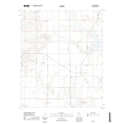
2018 Map of Ivan
USGS Topo · Published 2018About this map
The small community of Ivan serves as a central point in this rural Bossier Parish landscape, where the terrain is defined by a complex network of creeks and drainage sloughs. Water features such as Bounds Br, Phillips Cr, and Caney Cr wind through the township lines of T21N and T22N, feeding into larger systems like Ivan Lake. The area is notably marked by several family and community burial grounds, including the Smith-Gilmer Cem and Emma Cem, which provide significant points of interest for genealogists tracing local heritage. Toward the southern portion of the map, the drainage patterns become more pronounced near Crossway Slu and Young Br, reflecting the low-lying nature of the region. Local roads like Pilkinton Rd and Whittington Rd connect these dispersed landmarks, tracing the historical movement of residents between the woods and water.
Find a feature on this map
45 named features on this map. Tap any name to fly to it.
Don’t see what you’re looking for? This feature index may not catch every label — zoom into the map to look around manually.
Map Details
Editions of this 2018 Ivan Map
This is the sole edition of this map. No revisions or reprints were ever made.
Other maps of this area

1922 · Sarepta
USGS Topo · 1:62,500

1924 · Sarepta
USGS Topo · 1:62,500

1932 · Bossier NE
USGS Topo · 1:31,680

1932 · Bossier NW
USGS Topo · 1:31,680

1947 · Minden
USGS Topo · 1:62,500

1948 · Bossier City
USGS Topo · 1:62,500

1949 · Minden
USGS Topo · 1:62,500

1950 · Plain Dealing SW
USGS Topo · 1:31,680

1950 · Plain Dealing NE
USGS Topo · 1:31,680

1950 · Plain Dealing SE
USGS Topo · 1:31,680