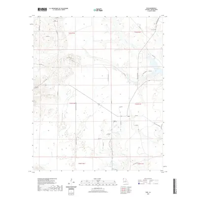
2020 Map of Ivan
USGS Topo · Published 2020About this map
Ivan Lake dominates the northeastern landscape of this Bossier Parish region, a prominent water body fed by streams like Phillips Cr and Caney Cr. The area is defined by its deep genealogical roots, evidenced by numerous family and community burial grounds including the Smith - Gilmer Cem, Galilee Cem, and Emma Cem. The settlement of Ivan serves as a central point for a network of rural roads such as Pilkinton Rd and Walker Rd. Southward, the terrain transitions into the wetlands of Crossway Slu and the drainages of Young Br. This 2020 record illustrates a land managed for timber and recreation, with specialized routes like Red Dirt Hunting Club Rd and Blue Tick Hunting Rd cutting through the wooded tracts that characterize this part of Louisiana.
Find a feature on this map
50 named features on this map. Tap any name to fly to it.
Don’t see what you’re looking for? This feature index may not catch every label — zoom into the map to look around manually.
Map Details
Editions of this 2020 Ivan Map
This is the sole edition of this map. No revisions or reprints were ever made.
Other maps of this area

1922 · Sarepta
USGS Topo · 1:62,500

1924 · Sarepta
USGS Topo · 1:62,500

1932 · Bossier NE
USGS Topo · 1:31,680

1932 · Bossier NW
USGS Topo · 1:31,680

1947 · Minden
USGS Topo · 1:62,500

1948 · Bossier City
USGS Topo · 1:62,500

1949 · Minden
USGS Topo · 1:62,500

1950 · Plain Dealing SW
USGS Topo · 1:31,680

1950 · Plain Dealing NE
USGS Topo · 1:31,680

1950 · Plain Dealing SE
USGS Topo · 1:31,680