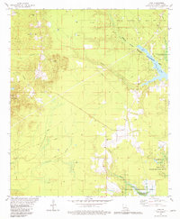
1981 Map of Ivan
USGS Topo · Published 1981About this map
The Sarrepta Oil and Gas Field dominates the northern landscape of this Bossier Parish region, where numerous oil and gas wells are interspersed among the drainages of Caney Creek and Flat Branch. This early 1980s landscape shows the intersection of industry and conservation, with large portions of the terrain dedicated to the Bodcau State Wildlife Management Area and the waters of the Bayou Bodcau Reservoir. Small settlements like Ivan and Rocky Mount serve as local anchors, connected by a network of roads and the visible trace of an Old Railroad Grade.
Find a feature on this map
26 named features on this map. Tap any name to fly to it.
Don’t see what you’re looking for? This feature index may not catch every label — zoom into the map to look around manually.
Map Details
Editions of this 1981 Ivan Map
This is the sole edition of this map. No revisions or reprints were ever made.
Other maps of this area

1922 · Sarepta
USGS Topo · 1:62,500

1924 · Sarepta
USGS Topo · 1:62,500

1932 · Bossier NE
USGS Topo · 1:31,680

1932 · Bossier NW
USGS Topo · 1:31,680

1947 · Minden
USGS Topo · 1:62,500

1948 · Bossier City
USGS Topo · 1:62,500

1949 · Minden
USGS Topo · 1:62,500

1950 · Plain Dealing SW
USGS Topo · 1:31,680

1950 · Plain Dealing NE
USGS Topo · 1:31,680

1950 · Plain Dealing SE
USGS Topo · 1:31,680