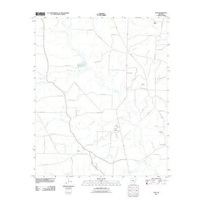
2011 Map of Ivan
USGS Topo · Published 2011About this map
Ivan and Oak Grove anchor this 2011 survey of Cleveland County, Arkansas, where the landscape is defined by a dense network of watercourses and family-named landmarks. The area is heavily intersected by branches of Moro Creek, including Grisly Creek, Toad Creek, and Fools Head Creek. These streams dictate the positioning of the local road system, which includes distinctive routes like Whiskey Still Rd, Pump Station Rd, and Hastings Camp Rd.
Find a feature on this map
62 named features on this map. Tap any name to fly to it.
Don’t see what you’re looking for? This feature index may not catch every label — zoom into the map to look around manually.
Map Details
Editions of this 2011 Ivan Map
This is the sole edition of this map. No revisions or reprints were ever made.
Other maps of this area

1903 · Camden
USGS Topo · 1:125,000

1953 · El Dorado
USGS Topo · 1:250,000

1955 · Little Rock
USGS Topo · 1:250,000

1956 · Little Rock
USGS Topo · 1:250,000

1957 · El Dorado
USGS Topo · 1:250,000

1958 · El Dorado
USGS Topo · 1:250,000

1960 · El Dorado
USGS Topo · 1:250,000

1960 · Little Rock
USGS Topo · 1:250,000

1964 · Little Rock
USGS Topo · 1:250,000

1964 · Staves
USGS Topo · 1:24,000