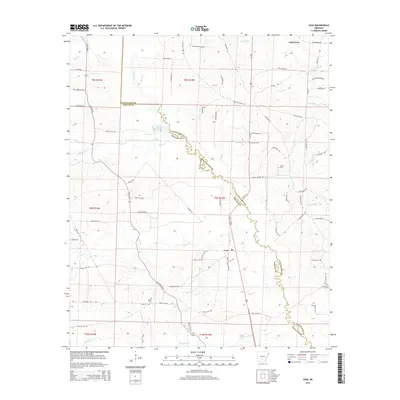
2014 Map of Ivan
USGS Topo · Published 2014About this map
Moro Cr meanders south through the center of this landscape, defining the winding boundary between Cleveland and Dallas Counties. The area is characterized by a dense network of creeks, including Hurricane Cr, Beech Cr, and the curiously named Fools Head Cr, which feed the larger drainage system of the region. Transportation is anchored by Us-167 and AR 229 Hwy, connecting the small settlements of Oak Grove in the north to Ivan further south. Genealogists and local historians will find several family-named landmarks scattered across the terrain, notably Garner Cem, Tolson Cem, Broach Cem, and Dixon Cem. The map illustrates a rural Arkansas economy linked by a web of local roads such as Hastings Camp Rd and Hampton Garner Rd, reflecting decades of local land use and residency.
Find a feature on this map
83 named features on this map. Tap any name to fly to it.
Don’t see what you’re looking for? This feature index may not catch every label — zoom into the map to look around manually.
Map Details
Editions of this 2014 Ivan Map
This is the sole edition of this map. No revisions or reprints were ever made.
Other maps of this area
1903 · Camden
USGS Topo · 1:125,000

1953 · El Dorado
USGS Topo · 1:250,000
1955 · Little Rock
USGS Topo · 1:250,000
1956 · Little Rock
USGS Topo · 1:250,000
1957 · El Dorado
USGS Topo · 1:250,000
1958 · El Dorado
USGS Topo · 1:250,000
1960 · El Dorado
USGS Topo · 1:250,000
1960 · Little Rock
USGS Topo · 1:250,000
1964 · Little Rock
USGS Topo · 1:250,000
1964 · Staves
USGS Topo · 1:24,000