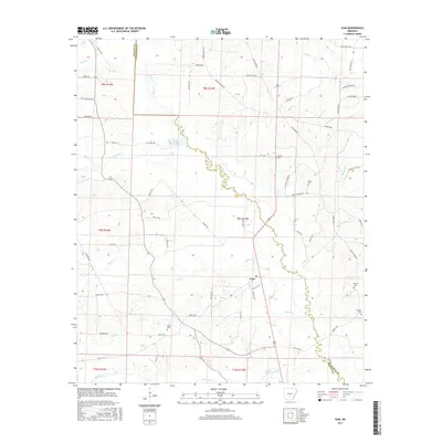
2017 Map of Ivan
USGS Topo · Published 2017About this map
The settlement of Ivan anchors this section of south-central Arkansas, situated near the boundary line of Dallas and Cleveland Counties. The landscape is defined by the winding course of Moro Cr, which serves as a natural dividing line between the two counties and is fed by numerous tributaries such as Guice Cr and Beech Cr. The topography consists of low-lying creek bottoms and subtle ridges where early settlement patterns are visible through a network of local roads with evocative names like Whiskey Still Rd and Hastings Camp Rd. Genealogists will find a high concentration of family burial grounds scattered across the terrain, including Garner Cem, Tolson Cem, and Dixon Cem. The southern edge of the map is dominated by the floodplains of Hurricane Cr, showing the rural, timbered character of the region in the early 21st century.
Find a feature on this map
70 named features on this map. Tap any name to fly to it.
Don’t see what you’re looking for? This feature index may not catch every label — zoom into the map to look around manually.
Map Details
Editions of this 2017 Ivan Map
This is the sole edition of this map. No revisions or reprints were ever made.
Other maps of this area
1903 · Camden
USGS Topo · 1:125,000

1953 · El Dorado
USGS Topo · 1:250,000
1955 · Little Rock
USGS Topo · 1:250,000
1956 · Little Rock
USGS Topo · 1:250,000
1957 · El Dorado
USGS Topo · 1:250,000
1958 · El Dorado
USGS Topo · 1:250,000
1960 · El Dorado
USGS Topo · 1:250,000
1960 · Little Rock
USGS Topo · 1:250,000
1964 · Little Rock
USGS Topo · 1:250,000
1964 · Staves
USGS Topo · 1:24,000