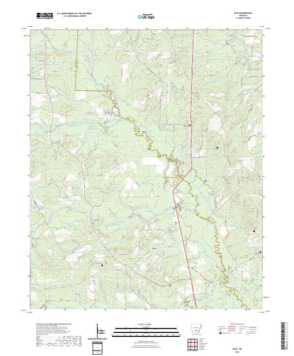
2024 Map of Ivan
USGS Topo · Published 2024About this map
Moro Creek winds through a landscape defined by timber tracts and family legacy along the border of Dallas and Cleveland Counties. The small settlement of Ivan serves as a central point, surrounded by a network of rural roads such as Grace Church Rd and Hampton Garner Rd that connect isolated homesteads and timber operations. This area of South Central Arkansas maintains a traditional rural structure, where small burial grounds like Tolson Cem and Garner Cem are tucked into the woodlands, preserving the names of early local families.
Find a feature on this map
71 named features on this map. Tap any name to fly to it.
Don’t see what you’re looking for? This feature index may not catch every label — zoom into the map to look around manually.
Map Details
Editions of this 2024 Ivan Map
This is the sole edition of this map. No revisions or reprints were ever made.
Other maps of this area

1903 · Camden
USGS Topo · 1:125,000

1953 · El Dorado
USGS Topo · 1:250,000

1955 · Little Rock
USGS Topo · 1:250,000

1956 · Little Rock
USGS Topo · 1:250,000

1957 · El Dorado
USGS Topo · 1:250,000

1958 · El Dorado
USGS Topo · 1:250,000

1960 · El Dorado
USGS Topo · 1:250,000

1960 · Little Rock
USGS Topo · 1:250,000

1964 · Little Rock
USGS Topo · 1:250,000

1964 · Staves
USGS Topo · 1:24,000