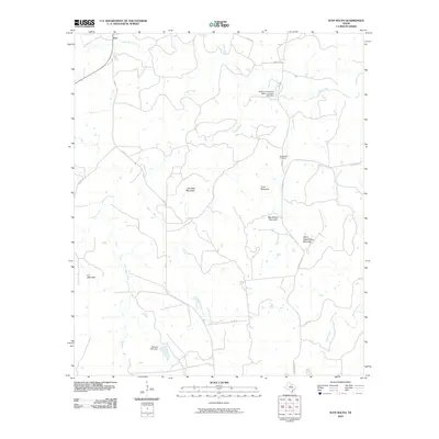
2010 Map of Ivan South
USGS Topo · Published 2010About this map
Ivan anchors the northern reaches of this north-central Texas landscape, situated at the junction of FM 717 and Co RD 181. The terrain is defined by a series of prominent rises including Devils Reservation Mountain, Coon Mountain, and Lime Rock Mountain, which overlook a network of seasonal watercourses. The hydrology of the area is managed through significant engineering such as the Stephens Company Water Company Lake Dam and the Monroe Veal Dam, indicating the region's reliance on water infrastructure for local industry and agriculture.
Find a feature on this map
23 named features on this map. Tap any name to fly to it.
Don’t see what you’re looking for? This feature index may not catch every label — zoom into the map to look around manually.
Map Details
Editions of this 2010 Ivan South Map
This is the sole edition of this map. No revisions or reprints were ever made.
Other maps of this area

1890 · Breckenridge
USGS Topo · 1:125,000

1924 · Breckenridge 1-a
USGS Topo · 1:48,000

1924 · Breckenridge 1-d
USGS Topo · 1:48,000

1925 · Breckenridge 1-b
USGS Topo · 1:48,000

1931 · Ivan
USGS Topo · 1:62,500

1954 · Abilene
USGS Topo · 1:250,000

1958 · Abilene
USGS Topo · 1:250,000

1967 · Necessity
USGS Topo · 1:24,000
1967 · Grand Lake
USGS Topo · 1:24,000
1967 · Brad
USGS Topo · 1:24,000