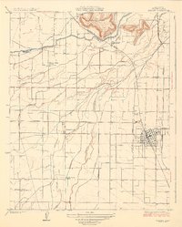
1950 Map of Ivanhoe
USGS Topo · Published 1964About this map
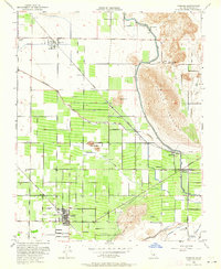
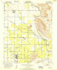
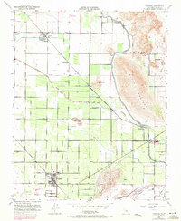
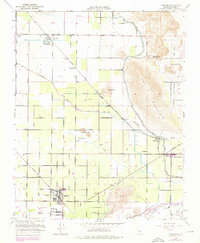
Agricultural development defines the San Joaquin Valley landscape near Ivanhoe at mid-century. A complex network of irrigation infrastructure, including the massive Friant Kern Canal, Wutchumna Ditch, and Sontag Ditch, sustains the orchards and fields that dominate the valley floor. Transportation for these products is provided by the Southern Pacific and the Atchison Topeka and Santa Fe railroads, which connect smaller shipping points like Seville, Redbanks, and Hillmaid. Standing in sharp relief against the flat, productive plains are the Colvin Mountain and Venice Hills, which provide topographical contrast to the surrounding terrain. Local community life is evidenced by the Paloma School, St Maries Church, and the Lone Oak Cem, while the County Industrial Camp reflects the labor and civic administration of the period.
Find a feature on this map
35 named features on this map. Tap any name to fly to it.
Don’t see what you’re looking for? This feature index may not catch every label — zoom into the map to look around manually.
Map Details
Editions of this 1950 Ivanhoe Map
4 editions found
Other maps of this area

1921 · Stokes Mountain
USGS Topo · 1:24,000

1922 · Trimmer
USGS Topo · 1:96,000

1923 · Sultana
USGS Topo · 1:31,680

1924 · Dinuba
USGS Topo · 1:125,000

1924 · Stokes Mountain
USGS Topo · 1:31,680

1925 · Rocky Hill
USGS Topo · 1:31,680

1926 · Ivanhoe
USGS Topo · 1:31,680
1926 · Exeter
USGS Topo · 1:31,680
1927 · Monson
USGS Topo · 1:31,680
1927 · Rocky Hill
USGS Topo · 1:31,680