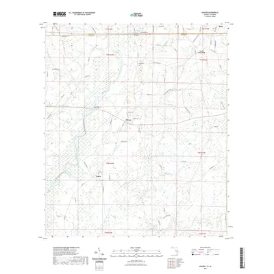
2021 Map of Izagora
USGS Topo · Published 2021About this map
Izagora and Black anchor this survey of the Florida-Alabama borderlands, where the Choctawhatchee River defines the landscape as it winds southward through Geneva and Holmes Counties. The river's influence is central to the area's geography, evidenced by the Choctawhatchee River Blueway Trl and the crossing at the James-Riley 'Jim' Paul Bridge. Small agricultural and residential clusters like Pittman and Smith Crossroads are connected by a network of rural routes such as Co Rd 179 and Dale Robinson Rd. Local history is preserved at the Whitewater Cem near the river's edge and Curry Cem further south. The southern portion of the map transitions into a lake-studded terrain featuring Blue Lake and Blackfish Lake, while the Albertson Stretch suggests a distinctive segment of the river's channel.
Find a feature on this map
86 named features on this map. Tap any name to fly to it.
Don’t see what you’re looking for? This feature index may not catch every label — zoom into the map to look around manually.
Map Details
Editions of this 2021 Izagora Map
This is the sole edition of this map. No revisions or reprints were ever made.
Other maps of this area

1942 · Enterprise
USGS Topo · 1:125,000

1949 · Hobbs Crossroads
USGS Topo · 1:24,000

1949 · Caryville
USGS Topo · 1:24,000

1950 · Hobbs Cross Roads
USGS Topo · 1:24,000

1950 · Prosperity
USGS Topo · 1:24,000

1950 · Caryville
USGS Topo · 1:24,000

1950 · Izagora
USGS Topo · 1:24,000

1950 · Esto
USGS Topo · 1:24,000

1951 · Esto
USGS Topo · 1:24,000

1951 · Bonifay
USGS Topo · 1:24,000