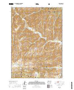
2020 Map of Izee
USGS Topo · Published 2020About this map
Izee sits at the heart of this central Oregon landscape, where the South Fork John Day Wild and Scenic River carves a deep valley through the high country. This cattle-ranching region, characterized by its dramatic gulches and timbered peaks, is bounded by the Malheur National Forest to the north and south. Local landmarks like Schoolhouse Gulch and the Izee Cem reflect the rural heritage of the area, while names such as Moonshine Alley, Snake Den, and Hole-in-the-Ground suggest a colorful history of settlement and exploration in Grant County. The map details a complex network of forest and county roads, including the Izee-Paulina Ln, which connects isolated flats and ridges. High elevations are marked by Harrison Mtn, Morgan Mtn, and volcanic features like Sheep Creek Butte, defining the drainage patterns for numerous seasonal creeks like Poison Cr and Elkhorn Cr.
Find a feature on this map
48 named features on this map. Tap any name to fly to it.
Don’t see what you’re looking for? This feature index may not catch every label — zoom into the map to look around manually.
Map Details
Editions of this 2020 Izee Map
This is the sole edition of this map. No revisions or reprints were ever made.
Other maps of this area

1932 · Dayville
USGS Topo · 1:125,000

1936 · Dayville
USGS Topo · 1:125,000

1955 · Burns
USGS Topo · 1:250,000

1955 · Canyon City
USGS Topo · 1:250,000

1958 · Burns
USGS Topo · 1:250,000

1959 · Burns
USGS Topo · 1:250,000

1959 · Canyon City
USGS Topo · 1:250,000

1959 · Sawtooth Creek
USGS Topo · 1:62,500

1961 · Delintment Lake
USGS Topo · 1:62,500

1961 · Izee
USGS Topo · 1:62,500