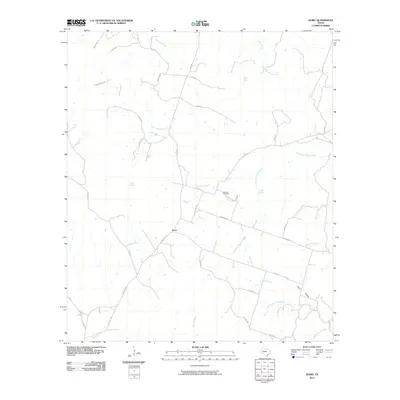
2010 Map of Izoro
USGS Topo · Published 2010About this map
Izoro serves as the central hub of this Central Texas landscape, where a network of rural routes like Farm Rd 1690 and FM 581 connect the scattered homesteads of Lampasas County. The area is defined by its spring-fed hydrology, notably Dumas Spring and Soldiers Spring, which feed into a complex system of local waterways including South Bee House Creek and Soldiers Spring Creek. Genealogists and local historians will find the Hillsdale Cemetery located along Hillsdale Rd, a key landmark for tracing family roots in this ranching community. The terrain is marked by significant drainages such as Plum Hollow and North Table Rock Creek, illustrating the natural drainage patterns toward the Leon River watershed beyond the quadrangle's borders. This 2010 survey records the persistent rural character of the region, where family-named roads like Daughterly Rd and Mariott Rd trace the long-standing property lines of the Texas Hill Country's northern edge.
Find a feature on this map
40 named features on this map. Tap any name to fly to it.
Don’t see what you’re looking for? This feature index may not catch every label — zoom into the map to look around manually.
Map Details
Editions of this 2010 Izoro Map
This is the sole edition of this map. No revisions or reprints were ever made.
Other maps of this area

1887 · Lampasas
USGS Topo · 1:125,000

1894 · Lampasas
USGS Topo · 1:125,000

1894 · Gatesville
USGS Topo · 1:125,000

1947 · Fort Hood
USGS Topo · 1:62,500

1947 · Purmela
USGS Topo · 1:62,500

1947 · Pidcoke
USGS Topo · 1:24,000

1947 · Purmela
USGS Topo · 1:24,000

1947 · Twin Moutains
USGS Topo · 1:24,000

1954 · Brownwood
USGS Topo · 1:250,000

1954 · Evant
USGS Topo · 1:62,500