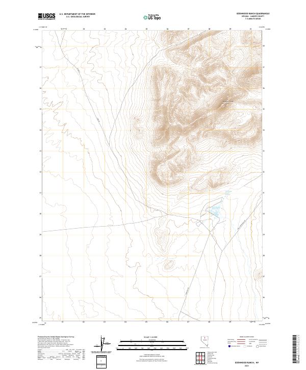
2021 Map of Izzenhood Ranch
USGS Topo · Published 2021About this map
Izzenhood Ranch Springs and the nearby Izzenhood Reservoir serve as the primary focal points of this high-desert landscape in northern Nevada. The terrain is dominated by the prominent ridge of Roosters Comb to the northeast, which rises sharply above the surrounding flats. A sparse network of unpaved roads, including Izzed Rd, Izzenhood Rd, and Rock Creek Ranch Rd, provides the only access across the expansive ranch lands. This modern survey illustrates a landscape where survival and land use are dictated by the presence of water, with the ranch complex established near the natural springs and man-made reservoir to support livestock in an otherwise arid environment.
Find a feature on this map
10 named features on this map. Tap any name to fly to it.
Don’t see what you’re looking for? This feature index may not catch every label — zoom into the map to look around manually.
Map Details
Editions of this 2021 Izzenhood Ranch Map
This is the sole edition of this map. No revisions or reprints were ever made.
Other maps of this area

1882 · Paradise
USGS Topo · 1:250,000

1893 · Paradise
USGS Topo · 1:250,000

1932 · Sonoma Range
USGS Topo · 1:250,000

1939 · Sonoma Range
USGS Topo · 1:250,000

1955 · McDermitt
USGS Topo · 1:250,000

1955 · Winnemucca
USGS Topo · 1:250,000

1958 · Winnemucca
USGS Topo · 1:250,000

1959 · McDermitt
USGS Topo · 1:250,000

1962 · Winnemucca
USGS Topo · 1:250,000

1965 · Izzenhood Gap
USGS Topo · 1:24,000