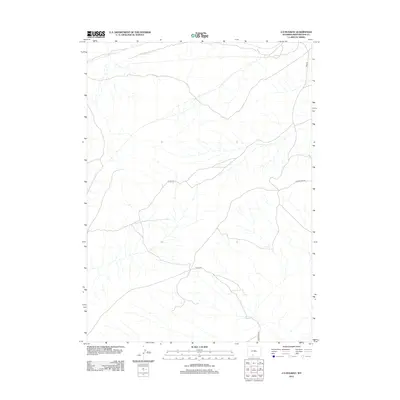
2012 Map of J O Dugway
USGS Topo · Published 2012About this map
Delaney Spring and a nameless Spring serve as rare water sources in this high-desert pocket of Sweetwater County. The landscape is defined by its isolation and the network of access routes maintained for resource management and ranching. Delaney Rim Rd traverses the eastern side of the sheet, following the natural contour of the land. This map documents a modern snapshot of the Red Desert region, where connectivity is provided by gravel and dirt thoroughfares such as Road 80 and Co Rd 4410. The prevalence of Bureau of Land Management routes, including Blm Road 4410, reflects the public land usage and grazing patterns that characterize this part of Wyoming.
Find a feature on this map
7 named features on this map. Tap any name to fly to it.
Don’t see what you’re looking for? This feature index may not catch every label — zoom into the map to look around manually.
Map Details
Editions of this 2012 J O Dugway Map
This is the sole edition of this map. No revisions or reprints were ever made.
Other maps of this area

1954 · Rock Springs
USGS Topo · 1:250,000

1958 · Rock Springs
USGS Topo · 1:250,000

1962 · Rock Springs
USGS Topo · 1:250,000

1970 · Red Desert SW
USGS Topo · 1:24,000

1970 · Table Rock
USGS Topo · 1:24,000

1970 · Red Desert NW
USGS Topo · 1:24,000

1970 · J O Dugway
USGS Topo · 1:24,000

1970 · Fort La Clede NE
USGS Topo · 1:24,000

1970 · Tipton
USGS Topo · 1:24,000
1970 · Haystack Flats
USGS Topo · 1:24,000