
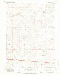
1970 Map of Tipton
USGS Topo · Published 1973About this map
The Continental Divide traverses the southern half of this landscape, separating the high desert drainage patterns within the Red Desert Basin. The terrain is defined by wide arid valleys such as Salt Sage Draw and Smiley Draw, where isolated wells and water tanks provided essential infrastructure for ranching and resource extraction. The southern margin of the map highlights a concentrated corridor of industrial and transportation activity, anchored by the Union Pacific railroad.
Find a feature on this map
16 named features on this map. Tap any name to fly to it.
Don’t see what you’re looking for? This feature index may not catch every label — zoom into the map to look around manually.
Map Details
Editions of this 1970 Tipton Map
This is the sole edition of this map. No revisions or reprints were ever made.
Other maps of this area

1954 · Rock Springs
USGS Topo · 1:250,000

1958 · Rock Springs
USGS Topo · 1:250,000

1960 · Red Lake
USGS Topo · 1:62,500

1960 · Lost Creek Butte
USGS Topo · 1:62,500

1962 · Rock Springs
USGS Topo · 1:250,000

1970 · Red Desert SW
USGS Topo · 1:24,000

1970 · Table Rock
USGS Topo · 1:24,000

1970 · Red Desert NW
USGS Topo · 1:24,000

1970 · J O Dugway
USGS Topo · 1:24,000
1970 · Desert Springs
USGS Topo · 1:24,000