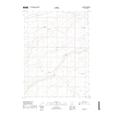
2017 Map of J O Dugway
USGS Topo · Published 2017About this map
The Continental Divide traverses this high desert landscape in Sweetwater County, marking a fundamental hydrologic boundary in the American West. This 2017 topographic study highlights the complex drainage patterns of the high plateau, where ephemeral water sources like Red Wash and Delaney Spring provide critical relief in an otherwise arid environment. The map details the local geography around the Delaney Rim, a prominent escarpment that defines much of the central terrain. Human passage through this high country is traced via the J O Dugway, a specific passage through the ridges that serves as a focal point for the regional road network. Remote access is maintained through a system of county and Bureau of Land Management routes, including Co RD 4410 and Delaney Rim Rd, which navigate the elevation changes between the rim and the basins below, including the area near J O Spring.
Find a feature on this map
16 named features on this map. Tap any name to fly to it.
Don’t see what you’re looking for? This feature index may not catch every label — zoom into the map to look around manually.
Map Details
Editions of this 2017 J O Dugway Map
This is the sole edition of this map. No revisions or reprints were ever made.
Other maps of this area

1954 · Rock Springs
USGS Topo · 1:250,000

1958 · Rock Springs
USGS Topo · 1:250,000

1962 · Rock Springs
USGS Topo · 1:250,000

1970 · Red Desert SW
USGS Topo · 1:24,000

1970 · Table Rock
USGS Topo · 1:24,000

1970 · Red Desert NW
USGS Topo · 1:24,000

1970 · J O Dugway
USGS Topo · 1:24,000

1970 · Fort La Clede NE
USGS Topo · 1:24,000

1970 · Tipton
USGS Topo · 1:24,000
1970 · Haystack Flats
USGS Topo · 1:24,000